Access
00%
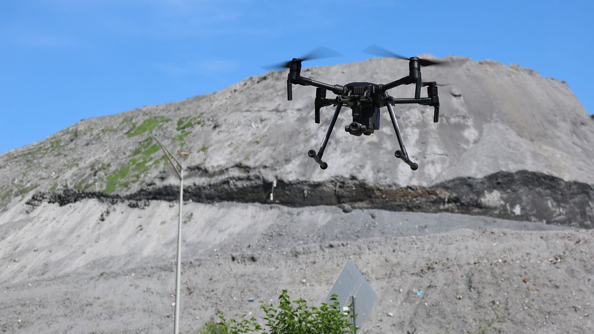
Survey drone in flight above an active construction site
Service · Aerial Drone

Eyes where access ends.

FAA-certificated remote pilots put a calibrated camera where a lift cannot go — roofs, façades, bridges, stockpiles and live sites — and bring back imagery, orthomosaics and models the project team can measure from.

Scroll to read
Capabilities · deliverables · flight method
01
The Brief

A photograph is not a measurement. A planned flight is.

Roofs, façades, stacks, bridge soffits and stockpiles are all inspectable — the difficulty is getting qualified eyes within reach of them without a lift, a swing stage or a lane closure. Aerial capture removes the access problem without lowering the standard.

Our remote pilots hold FAA Part 107 certification and fly to site-specific plans. What they bring back is reviewed by the same licensed engineers and certified inspectors who work the project from the ground.

Same Standard. New Vantage.

02 Capabilities

Inspect, survey, document.

Aerial capture replaces the swing stage, the hero shot and the guesswork with a dated, geolocated record. Scroll to fly the mission.

01

Inspection

  • Roof & façade condition surveys
  • Bridge & overpass inspection
  • Tower and stack access
  • Thermal & moisture imaging
  • Post-event damage assessment
  • Confined and high-risk areas

02

Survey & mapping

  • Orthomosaic site maps
  • Volumetrics & stockpile measurement
  • Topographic surface models
  • 3D photogrammetry models
  • Cut & fill verification
  • Georeferenced deliverables

03

Documentation

  • Monthly progress capture
  • As-built photo record
  • Marketing & owner imagery
  • Site logistics planning views
  • Airspace authorization
  • Flight logs & data retention
03
Deliverables

What lands on your desk after the flight.

ORTHO
Site orthomosaic
One scaled, georeferenced top-down image of the whole site, exportable to CAD and GIS.
MODEL
3D surface model
Point cloud and textured mesh for volume, grade and as-built comparison against design.
THERM
Thermal report
Radiometric imagery with flagged anomalies referenced to building elevations and roof zones.
VOL
Volumetric report
Stockpile and earthwork quantities with the survey basis, control points and tolerance stated.
SET
Progress photo set
Captioned, dated imagery flown on a repeatable grid so any two months line up exactly.
LOG
Flight record
Pilot certificate, airspace authorization and flight logs retained and issued with the deliverable.
04
Flight Method

Cleared, flown, processed, reviewed.

Every flight is planned around the airspace, the site and the deliverable the engineer actually needs — in that order.

01
Airspace & authorization
Controlled-airspace requests, LAANC and waivers are resolved before mobilization, with a site-specific flight plan on file.
02
Site & safety planning
Overflight limits, launch points, pedestrian control and weather windows are agreed with the site team in advance.
03
Capture
Certificated pilots fly a fixed grid at set altitude and overlap, so imagery from one month is directly comparable to the next.
04
Processing
Imagery is processed into orthomosaics, surfaces and models with measurable scale and a stated accuracy basis.
05
Engineering review
Findings are reviewed by the same licensed engineers and certified inspectors who assess the structure from the ground.

An aerial photograph is marketing. A georeferenced deliverable with a flight log behind it is evidence.

Where to next

Have a site that needs eyes overhead?

Send the location, the airspace and the deliverable you need. We will confirm authorization requirements and turnaround before we mobilize.